
Archivo:Antarctic Ocean location map.svg

Tamaño de esta previsualización PNG del archivo SVG: 600 × 600 píxeles. Otras resoluciones: 240 × 240 píxeles · 480 × 480 píxeles · 768 × 768 píxeles · 1024 × 1024 píxeles · 2048 × 2048 píxeles · 709 × 709 píxeles.
Ver la imagen en su resolución original ((Imagen SVG, nominalmente 709 × 709 pixels, tamaño de archivo: 243 kB))
Resumen
| Descripción |
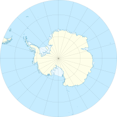
English: Location map of the Antarctic Ocean
|
| Fecha | |
| Fuente | Trabajo propio |
| Autor | Tentotwo |
| Otras versiones |
|

Licencia
Yo, el titular de los derechos de autor de esta obra, la publico en los términos de la siguiente licencia:
Este archivo se encuentra bajo la licencia Creative Commons Genérica de Atribución/Compartir-Igual 3.0.
- Eres libre:
- de compartir – de copiar, distribuir y transmitir el trabajo
- de remezclar – de adaptar el trabajo
- Bajo las siguientes condiciones:
- atribución – Debes otorgar el crédito correspondiente, proporcionar un enlace a la licencia e indicar si realizaste algún cambio. Puedes hacerlo de cualquier manera razonable pero no de manera que sugiera que el licenciante te respalda a ti o al uso que hagas del trabajo.
- compartir igual – En caso de mezclar, transformar o modificar este trabajo, deberás distribuir el trabajo resultante bajo la misma licencia o una compatible como el original.
Shell script for generating the map using GMT archive copy at the Wayback Machine
#!/bin/sh

# Set common options
PROJECTION=E0.0/-90.0/20.0c
REGION=-180/180/-90/-50
FILENAME=Antarctic_Ocean_location_map.ps

# Get Natural Earth datafiles
echo "Downloading datafiles from naturalearthdata.com"
wget -nv -nc \
 http://www.naturalearthdata.com/http//www.naturalearthdata.com/download/50m/physical/50m-coastline.zip\
 http://www.naturalearthdata.com/http//www.naturalearthdata.com/download/50m/physical/50m-land.zip\
 http://www.naturalearthdata.com/http//www.naturalearthdata.com/download/50m/cultural/50m-admin-0-boundary-lines.zip\
 http://www.naturalearthdata.com/http//www.naturalearthdata.com/download/50m/physical/50m-antarctic-ice-shelves-polys.zip\
 http://www.naturalearthdata.com/http//www.naturalearthdata.com/download/50m/physical/50m-antarctic-ice-shelves-lines.zip
echo "...done\n"

echo "Inflating archives"
unzip 50m\*.zip
echo "...done\n"

echo "Converting shapefiles to GMT"
ogr2ogr -F GMT 50m_land.gmt 50m_land.shp
ogr2ogr -F GMT 50m_coastline.gmt 50m_coastline.shp
ogr2ogr -F GMT 50m_borders.gmt ne_50m_admin_0_boundary_lines_land.shp
ogr2ogr -F GMT 50m_ice.gmt 50m_antarctic_ice_shelves_polys.shp
ogr2ogr -F GMT 50m_ice_borders.gmt 50m_antarctic_ice_shelves_lines.shp
echo "...done\n"

echo "Creating maps"
GMT psxy -m -J$PROJECTION -R$REGION -Bg15 --POLAR_CAP=none --BASEMAP_TYPE=plain --BASEMAP_AXES=N --FRAME_PEN=0.15p,black 50m_land.gmt -K -G254/254/233 > $FILENAME
GMT psxy -m -J$PROJECTION -R$REGION 50m_ice.gmt -O -K -G236/249/255 >> $FILENAME
GMT psxy -m -J$PROJECTION -R$REGION 50m_coastline.gmt -O -K -W0.535p,9/120/171  >> $FILENAME
GMT psxy -m -J$PROJECTION -R$REGION 50m_ice_borders.gmt -O -K -W0.27p,9/120/171  >> $FILENAME
GMT psxy -m -J$PROJECTION -R$REGION 50m_borders.gmt -O -W100/100/100  >> $FILENAME
echo "...done\n"

echo "You can now open $FILENAME in Inkscape to clean up the file and save it as SVG. You should add an ocean coloured background and simplify the graticules using CTRL+L."
Historial del archivo
Haz clic sobre una fecha y hora para ver el archivo tal como apareció en ese momento.
| Fecha y hora | Miniatura | Dimensiones | Usuario | Comentario | |
|---|---|---|---|---|---|
| actual | 13:46 27 ene 2012 | | 709 × 709 (243 kB) | Tentotwo |
Usos del archivo
La siguiente página usa este archivo:
Uso global del archivo
Las wikis siguientes utilizan este archivo:
- Uso en az.wikipedia.org
- Uso en bg.wikipedia.org
- Uso en ce.wikipedia.org
- Uso en de.wikipedia.org
- Uso en en.wikisource.org
- User:EncycloPetey
- User talk:Zyephyrus
- User:Kathleen.wright5
- User:George Orwell III
- User:Magnus Manske
- User:William Maury Morris II
- User:Tannertsf
- User:Mpaa
- User:Beeswaxcandle/Works
- User:WeeJeeVee
- User:Slowking4
- User:Legofan94
- User:GreyHead
- User:Keith Edkins/Participation archive
- User:HueSatLum
- User:Pixelwarrior
- User:Denis Barthel
- User:WhatamIdoing
- User:Sushant savla
- User:EncycloPetey/Userboxes
- Uso en eo.wikipedia.org
- Uso en fr.wikipedia.org
- Uso en gl.wikipedia.org
- Uso en hu.wikipedia.org
- Uso en hy.wikipedia.org
- Uso en ka.wikipedia.org
- Uso en kk.wikipedia.org
- Uso en lv.wikipedia.org
- Uso en pl.wikipedia.org
- Uso en pl.wikibooks.org
- Uso en pl.wiktionary.org
Ver más uso global de este archivo.