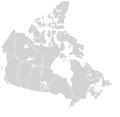
Archivo:Canada blank map.svg
Apariencia

Tamaño de esta previsualización PNG del archivo SVG: 709 × 600 píxeles. Otras resoluciones: 284 × 240 píxeles · 568 × 480 píxeles · 908 × 768 píxeles · 1211 × 1024 píxeles · 2422 × 2048 píxeles · 1114 × 942 píxeles.
Ver la imagen en su resolución original ((Imagen SVG, nominalmente 1114 × 942 pixels, tamaño de archivo: 205 kB))
Historial del archivo
Haz clic sobre una fecha y hora para ver el archivo tal como apareció en ese momento.
| Fecha y hora | Miniatura | Dimensiones | Usuario | Comentario | |
|---|---|---|---|---|---|
| actual | 23:30 16 nov 2020 |  | 1114 × 942 (205 kB) | MapGrid | Sync with File:Canada_location_map_2_-_lite.svg |
| 11:43 5 dic 2007 |  | 1304 × 1263 (113 kB) | Lokal Profil | Cleaned up code | |
| 21:25 9 ago 2007 |  | 1304 × 1263 (115 kB) | Rfc1394 | {{Information |Description={{en|Blank SVG map of Canada}} Non-contiguous parts of a states/provinces are "grouped" together with the main area of the state/provinces, so any state/provinces can be coloured in completion with one click anywhere on the stat |
Usos del archivo
No hay páginas que enlacen a este archivo.
Uso global del archivo
Las wikis siguientes utilizan este archivo:
- Uso en ca.wikipedia.org
- Uso en ca.wikimedia.org
- Uso en en.wikipedia.org
- Uso en fr.wikipedia.org
- Uso en os.wikipedia.org
- Uso en si.wikipedia.org
- Uso en sl.wikipedia.org
- Uso en uz.wikipedia.org
