
Archivo:Progreso and Merida satellite image.jpg
Tamaño de esta previsualización: 600 × 600 píxeles. Otras resoluciones: 240 × 240 píxeles · 480 × 480 píxeles · 768 × 768 píxeles · 1024 × 1024 píxeles · 2048 × 2048 píxeles · 3600 × 3600 píxeles.
Ver la imagen en su resolución original (3600 × 3600 píxeles; tamaño de archivo: 5,08 MB; tipo MIME: image/jpeg)
Resumen
| Descripción |
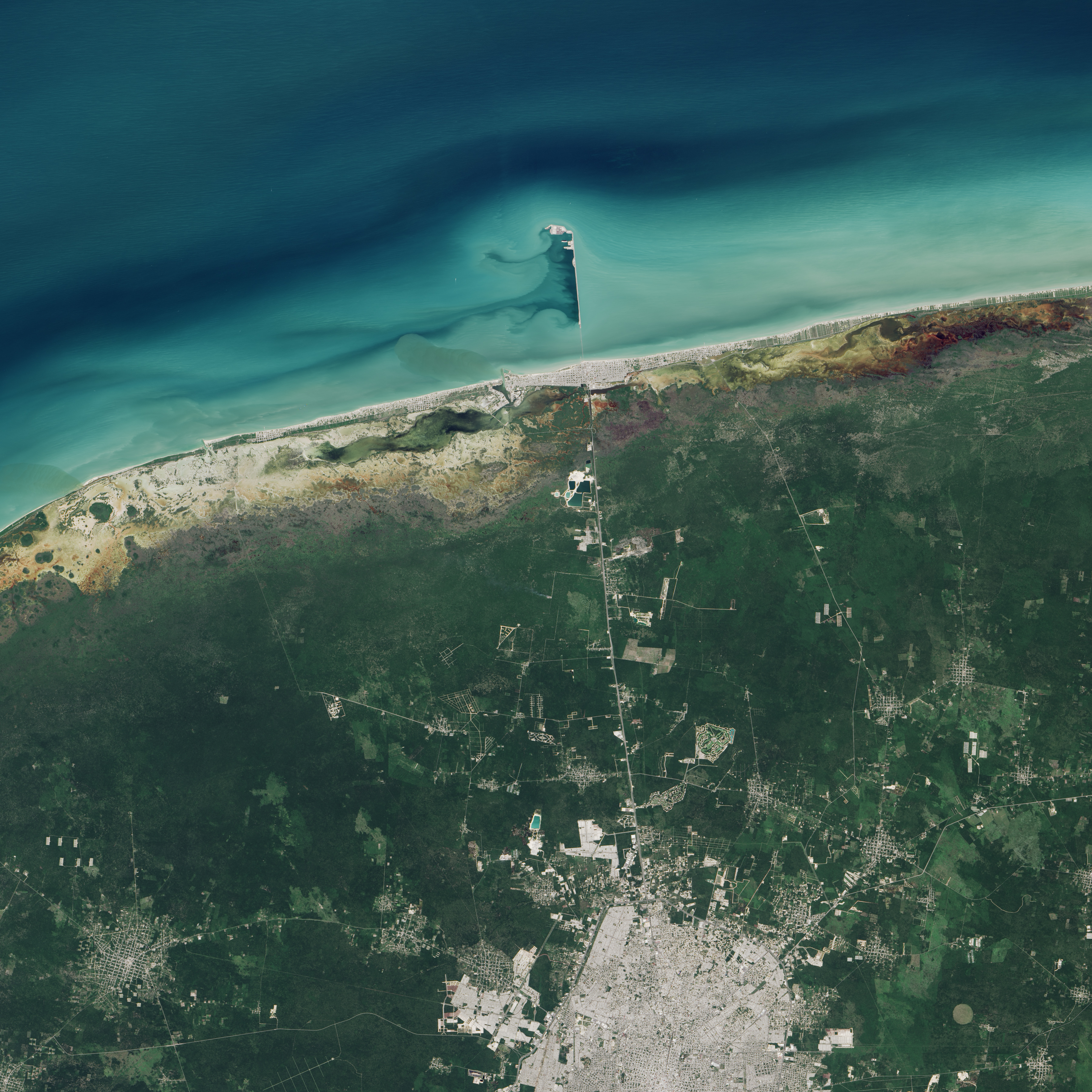
English: The Operational Land Imager (OLI) on Landsat 8 captured this image of Progreso's pier on November 5, 2014. According to Gabriela García-Rubio of the Ensenada Center for Scientific Research and Higher Education, light turquoise areas offshore are probably shallower than the darker areas. Prevailing winds here typically blow from the east-northeast, producing short-period waves and carrying sediment westward along the shore. |
| Fecha | |
| Fuente | Earth Viewed by Landsat 8 |
| Autor | NASA |
Licencia
| Este archivo es de dominio público porque fue creado por la NASA. Las políticas sobre copyright de la NASA estipulan que «el material de la NASA no está protegido con copyright a menos que se indique lo contrario». (Políticas sobre copyright de la NASA o Políticas sobre la utilización de imágenes del Jet Propulsion Laboratory). | ||
 |
Advertencias:
|
| Annotations | This image is annotated: View the annotations at Commons |
Historial del archivo
Haz clic sobre una fecha y hora para ver el archivo tal como apareció en ese momento.
| Fecha y hora | Miniatura | Dimensiones | Usuario | Comentario | |
|---|---|---|---|---|---|
| actual | 21:03 1 ago 2015 | | 3600 × 3600 (5,08 MB) | Jmagno1998 | User created page with UploadWizard |
Usos del archivo
La siguiente página usa este archivo: