
Archivo:1946 numbering.jpg

Tamaño de esta previsualización: 603 × 600 píxeles. Otras resoluciones: 241 × 240 píxeles · 482 × 480 píxeles · 772 × 768 píxeles · 1029 × 1024 píxeles · 1749 × 1740 píxeles.
Ver la imagen en su resolución original (1749 × 1740 píxeles; tamaño de archivo: 367 kB; tipo MIME: image/jpeg)
| Descripción |
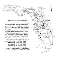
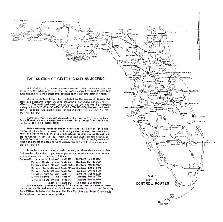
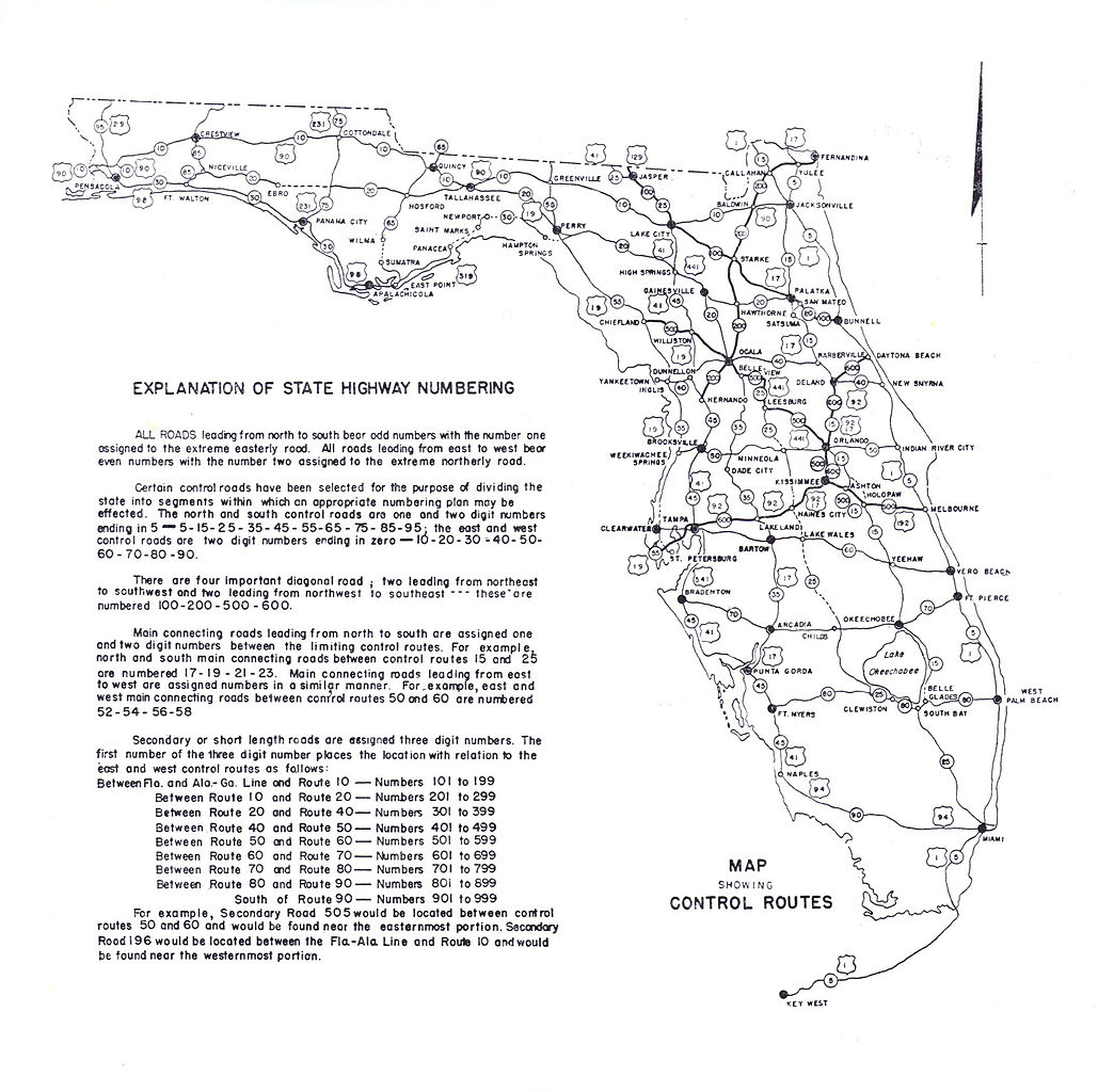
English: This is a map copyrighted by the State Road Department of Florida in 1946, showing the new numbering system. It comes from a larger map on Historical Maps of Florida at http://alabamamaps.ua.edu/historicalmaps/us_states/florida/index3.html. I searched Copyright renewal records at http://www.scils.rutgers.edu/~lesk/copyrenew.html and the SRD did not renew any copyrights. Therefore this map is now in the public domain.
Note: there is at least one typo; 20 between Gainesville and Ocala should read 25. |
|||
| Fecha | ||||
| Fuente | a larger map on Historical Maps of Florida at http://alabamamaps.ua.edu/historicalmaps/us_states/florida/index3.html | |||
| Autor | State Road Department of Florida | |||
| Permiso (Reutilización de este archivo) |
|
|||
| Otras versiones |
|


Historial del archivo
Haz clic sobre una fecha y hora para ver el archivo tal como apareció en ese momento.
| Fecha y hora | Miniatura | Dimensiones | Usuario | Comentario | |
|---|---|---|---|---|---|
| actual | 23:05 26 ago 2008 | | 1749 × 1740 (367 kB) | NE2 | There's no need for a full size version - when I try to load that one my browser stalls for a bit. |
| 11:24 4 nov 2007 |  | 3498 × 3479 (908 kB) | Jeff G. | Reverted to version as of 10:39, 12 October 2007 - no need for a half size version. | |
| 10:41 12 oct 2007 |  | 1749 × 1740 (367 kB) | NE2 | Cut to half the size; the full image is in the history if you need it. | |
| 10:39 12 oct 2007 |  | 3498 × 3479 (908 kB) | NE2 | This is a map copyrighted by the State Road Department of Florida in 1946, showing the new numbering system. It comes from a larger map on [http://alabamamaps.ua.edu/historicalmaps/us_states/florida/index3.html]. I searched [http://www.scils.rutgers.edu/~ |
Usos del archivo
La siguiente página usa este archivo: