
Archivo:CH-24 WAC 41 North.png
Tamaño de esta previsualización: 800 × 299 píxeles. Otras resoluciones: 320 × 120 píxeles · 640 × 239 píxeles · 1024 × 383 píxeles · 1280 × 478 píxeles · 5354 × 2000 píxeles.
Ver la imagen en su resolución original (5354 × 2000 píxeles; tamaño de archivo: 6,02 MB; tipo MIME: image/png)
| Descripción |
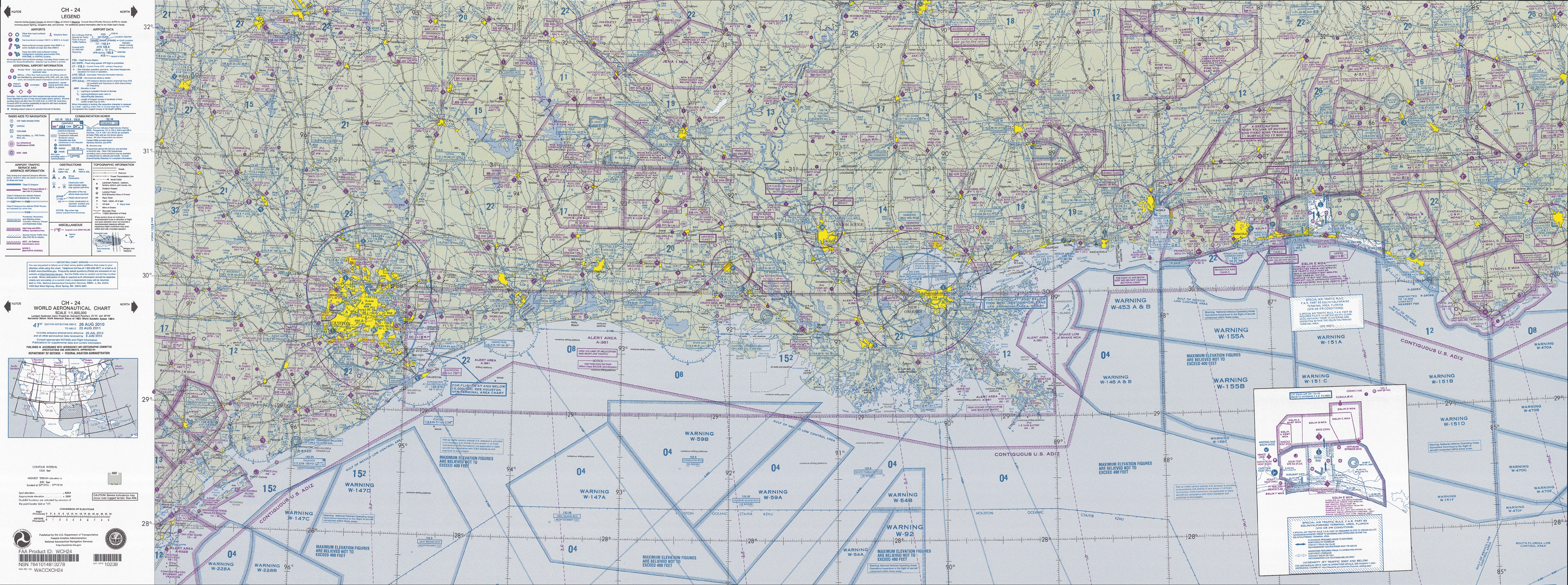
English: FAA World aeronautical chart CH 24 North, 41st edition (northern Gulf of Mexico). Note: This map is valid until 15 de agosto de 2011, for navigational purposes be sure to get the newest edition at the official FAA website |
| Fecha |
|
| Fuente | CH-24_WAC_41_North.tif in CH-23_41.zip. Note: The ZIP-File will become unavailable when the map is updated, newer editions will be available here |
| Autor | US Department of Transportation, Federal Aviation Administration, National Aeronautical Navigation Services |
| Otras versiones |
This image or file is a work of a Federal Aviation Administration employee, taken or made as part of that person's official duties. As a work of the U.S. federal government, the image is in the public domain in the United States.
|
 |
Historial del archivo
Haz clic sobre una fecha y hora para ver el archivo tal como apareció en ese momento.
| Fecha y hora | Miniatura | Dimensiones | Usuario | Comentario | |
|---|---|---|---|---|---|
| actual | 10:21 28 abr 2011 | 5354 × 2000 (6,02 MB) | El Grafo | {{Information |Description={{en|1=FAA World aeronautical chart CH 24 North, 41st edition (northern Gulf of Mexico). <small>Note: This map is valid until {{date|2011|08|15}}, for navigational purposes be sure to get the new |
Usos del archivo
Las siguientes páginas usan este archivo:
Uso global del archivo
Las wikis siguientes utilizan este archivo:
- Uso en de.wikipedia.org
- Uso en en.wikipedia.org
- Uso en fa.wikipedia.org