
Archivo:CycloneLarryFlooding MODIS 20060327.jpg
Tamaño de esta previsualización: 380 × 599 píxeles. Otras resoluciones: 152 × 240 píxeles · 540 × 851 píxeles.
Ver la imagen en su resolución original (540 × 851 píxeles; tamaño de archivo: 141 kB; tipo MIME: image/jpeg)
Resumen
| Descripción |
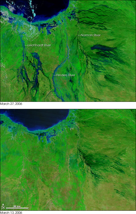
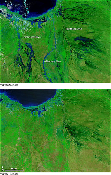
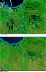
In the wake of Tropical Cyclone Larry, which plowed across Queensland the previous week, widespread flooding was affecting the region around the Gulf of Carpentaria on March 27, 2006. In this pair of false-color images, vegetation is green, naturally bare (or sparsely vegetated) ground is tan or pinkish-tan, and water is blue. Many rivers and streams that drain into the Gulf (top left) are swollen with flood water in the March 27 image, whereas on March 13, only dry riverbeds dissected the landscape. Among the rivers that experienced significant flooding were the Norman, the Flinders, and the Leichhardt Rivers. East of the Norman River and in the Leichhardt River basin, in the left side of the images, water has pooled over a large area, making the area seem like swamp land. According to an article on the Australian Broadcasting Corporation’s Website, the Leichhardt was so flooded that sharks were seen far inland of their normal location. |
|||||
| Fecha | ||||||
| Fuente | http://earthobservatory.nasa.gov/Newsroom/NewImages/images.php3?img_id=17227 | |||||
| Autor | NASA images courtesy MODIS Rapid Response Team, NASA-GSFC | |||||
| Permiso (Reutilización de este archivo) |
|
|||||
| Otras versiones | Larger, unannotated versions of both images available at source URL. |

Historial del archivo
Haz clic sobre una fecha y hora para ver el archivo tal como apareció en ese momento.
| Fecha y hora | Miniatura | Dimensiones | Usuario | Comentario | |
|---|---|---|---|---|---|
| actual | 20:22 27 abr 2006 | | 540 × 851 (141 kB) | Holly Cheng | {{Information | Description=Two images showing the extent of flooding caused by w:Cyclone Larry in Australia. | Source=http://earthobservatory.nasa.gov/Newsroom/NewImages/images.php3?img_id=17227 | Date=March 2006 | Author=NASA | Permission=US Governm |
Usos del archivo
La siguiente página usa este archivo:
Uso global del archivo
Las wikis siguientes utilizan este archivo:
- Uso en de.wikipedia.org
- Uso en en.wikipedia.org