
Archivo:Dakotatribesmap.jpg
Tamaño de esta previsualización: 800 × 583 píxeles. Otras resoluciones: 320 × 233 píxeles · 640 × 466 píxeles · 891 × 649 píxeles.
Ver la imagen en su resolución original (891 × 649 píxeles; tamaño de archivo: 212 kB; tipo MIME: image/jpeg)
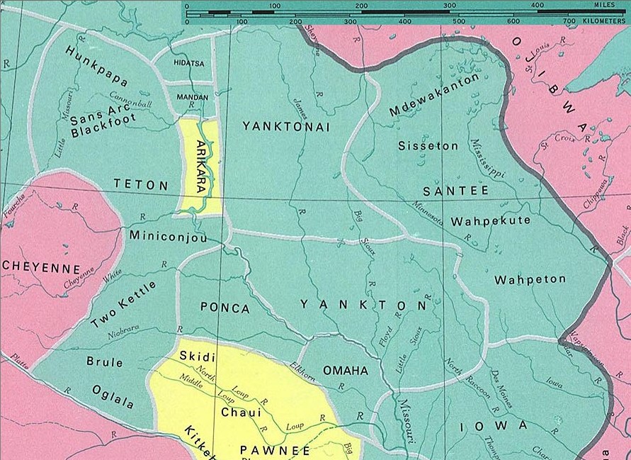
Dakota tribes
fragment from: http://www.lib.utexas.edu/maps/national_atlas_1970/ca000097.jpg
Most of the maps scanned by the University of Texas Libraries and served from this web site are in the public domain. No permissions are needed to copy them. You may download them and use them as you wish.
Este fichero se encuentra en dominio público porque Most of the maps scanned by the University of Texas Libraries and served from this web site (www.lib.utexas.edu) are in the public domain. No permissions are needed to copy them. You may download them and use them as you wish.
En algunos países esto no es legalmente posible, en ese caso: ¡Por favor, verifique que la razón dada arriba es válida!
|
also see

Historial del archivo
Haz clic sobre una fecha y hora para ver el archivo tal como apareció en ese momento.
| Fecha y hora | Miniatura | Dimensiones | Usuario | Comentario | |
|---|---|---|---|---|---|
| actual | 23:37 10 ene 2006 | | 891 × 649 (212 kB) | Pitert | Dakota tribes fragment from: http://www.lib.utexas.edu/maps/national_atlas_1970/ca000097.jpg {{PD}} |
Usos del archivo
La siguiente página usa este archivo:
Uso global del archivo
Las wikis siguientes utilizan este archivo:
- Uso en ca.wikipedia.org
- Uso en cs.wikipedia.org
- Uso en fi.wikipedia.org
- Uso en fr.wikipedia.org
- Uso en ja.wikipedia.org
- Uso en pl.wikipedia.org