
Archivo:Elk Mountains, Colorado (9181504734).jpg

Ver la imagen en su resolución original (4000 × 3000 píxeles; tamaño de archivo: 2,19 MB; tipo MIME: image/jpeg)
.jpg?uselang=es)
Resumen
| Descripción |
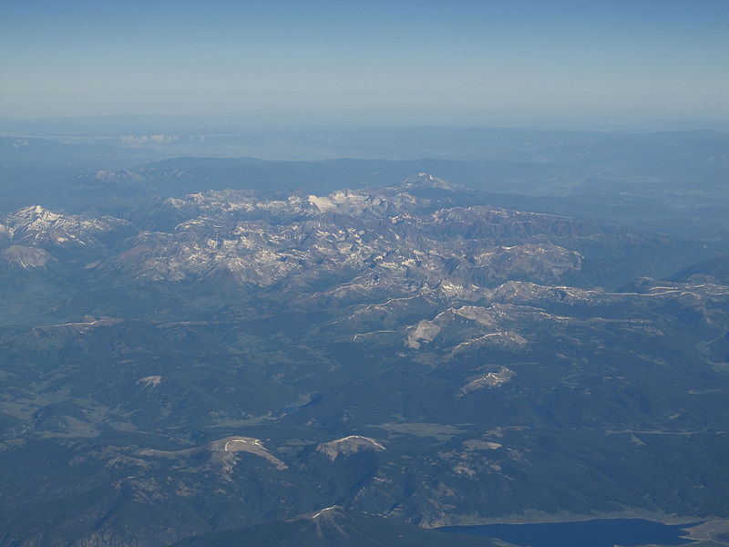
The Elk Mountains are a high, rugged mountain range in the Rocky Mountains of west-central Colorado in the United States. The mountains sit on the western side of the Continental Divide, largely in southern Pitkin and northern Gunnison counties, in the area southwest of Aspen, south of the Roaring Fork River valley, and east of the Crystal River. The range sits west of the Sawatch Range and northeast of the West Elk Mountains. Much of the range is located within the White River National Forest and the Gunnison National Forest, as well as the Maroon Bells-Snowmass Wilderness and Raggeds Wilderness. The Elk Mountains rise nearly 9,000 ft. above the Roaring Fork Valley to the north. The highest peaks in the range are its fourteeners, Castle Peak (14,265 ft), Maroon Peak (14,156 ft), Capitol Peak (14,130 ft), Snowmass Mountain (14,092 ft), Pyramid Peak (14,018 ft), and North Maroon Peak (14,014 ft).[1] Maroon Peak and North Maroon Peak are collectively known as the Maroon Bells, a popular destination for recreation alpinism. Mount Sopris (12,953 ft) sits at the northwest end of the range and dominates the skyline of the lower Roaring Fork Valley and the town of Carbondale, Colorado, serving as an unofficial symbol of the area. en.wikipedia.org/wiki/Elk_Mountains_(Colorado) en.wikipedia.org/wiki/Wikipedia:Text_of_Creative_Commons_... |
| Fecha | |
| Fuente | Elk Mountains, Colorado |
| Autor | Ken Lund from Reno, Nevada, USA |
| Posición de la cámara | | Ubicación de esta y otras imágenes en: OpenStreetMap |
|---|
.jpg¶ms=039.146861_N_-107.085735_E_globe:Earth_type:camera_source:Flickr_&language=es)
Licencia
- Eres libre:
- de compartir – de copiar, distribuir y transmitir el trabajo
- de remezclar – de adaptar el trabajo
- Bajo las siguientes condiciones:
- atribución – Debes otorgar el crédito correspondiente, proporcionar un enlace a la licencia e indicar si realizaste algún cambio. Puedes hacerlo de cualquier manera razonable pero no de manera que sugiera que el licenciante te respalda a ti o al uso que hagas del trabajo.
- compartir igual – En caso de mezclar, transformar o modificar este trabajo, deberás distribuir el trabajo resultante bajo la misma licencia o una compatible como el original.
| Esta imagen fue publicada en Flickr por Ken Lund en https://flickr.com/photos/75683070@N00/9181504734. La imagen fue revisada el 3 de diciembre de 2015 por el robot FlickreviewR y confirmó tener licencia bajo los términos de cc-by-sa-2.0. |
Historial del archivo
Haz clic sobre una fecha y hora para ver el archivo tal como apareció en ese momento.
| Fecha y hora | Miniatura | Dimensiones | Usuario | Comentario | |
|---|---|---|---|---|---|
| actual | 22:54 3 dic 2015 | | 4000 × 3000 (2,19 MB) | INeverCry | Transferred from Flickr via Flickr2Commons |
Usos del archivo
La siguiente página usa este archivo:
Uso global del archivo
Las wikis siguientes utilizan este archivo:
- Uso en pl.wikipedia.org
.jpg)