
Archivo:Hangman Bridge, Nuremberg, Bavaria, 1890s.jpg
Ver la imagen en su resolución original (3504 × 2604 píxeles; tamaño de archivo: 3,16 MB; tipo MIME: image/jpeg)
Resumen
| Descripción |
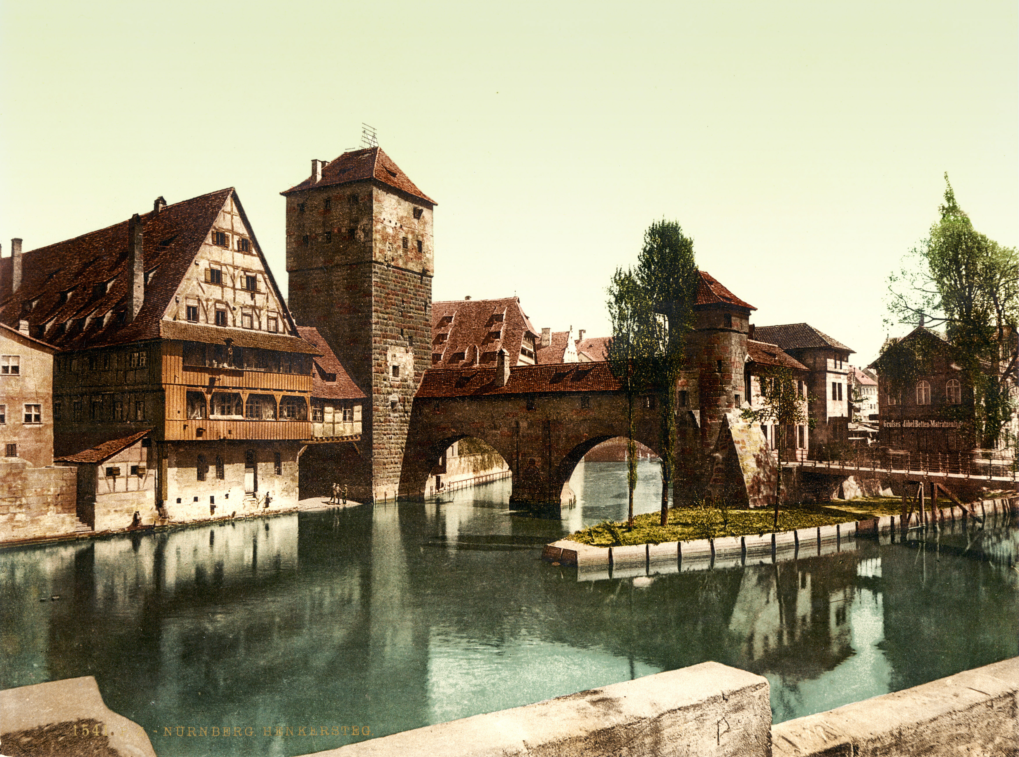
Hangman's Bridge (Henkersteg), Nuremberg (Nürnberg), Bavaria, Germany. 1 photomechanical print : photochrom, color. From www.nuernberg.de/internet/portal_e/reiseziel/ctz_2004.html: "The Hangman's Bridge (Henkersteg) was constructed in 1457 as a wooden bridge. Between the 16th and the 19th century, the Nuremberg hangman lived in the tower and the roofed walk above the river Pegnitz. After the flood of 1595, three arches of the town wall bridging the southern arm of the river Pegnitz were demolished and replaced by the wooden Hangman's Bridge with its tiled roof (reconstructed in 1954). The executioner had to live in segregated accommodation within the city, since his trade was considered "dishonest". Up until the Age of Enlightenment, citizens avoided any physical contact with the hangman, in order not to be excluded from the Christian community." |
||
| Fecha | entre 1890 y 1900 | ||
| Fuente |
|
||
| Autor | Photoglob Zürich, reprinted by Detroit Publishing Co. |

| Posición de la cámara | | Ubicación de esta y otras imágenes en: OpenStreetMap |
|---|
Licencia
The author of this image from Switzerland is unknown, and the image was published at least 70 years ago. It is therefore in the public domain in Switzerland by virtue of Art. 31 of the Swiss Copyright Act.
|
 |
Historial del archivo
Haz clic sobre una fecha y hora para ver el archivo tal como apareció en ese momento.
| Fecha y hora | Miniatura | Dimensiones | Usuario | Comentario | |
|---|---|---|---|---|---|
| actual | 16:13 12 ago 2010 | | 3504 × 2604 (3,16 MB) | BotMultichillT | {{Information |Description=Hangman Bridge (Henkersteg), Nuremberg (Nürnberg), Bavaria, Germany. Photochrom print by [http://en.wikipedia.org/wiki/Photochrom Photoglob Zürich], between 1890 and 1900. From [http://www.nuernberg.de/internet/portal_e/reise |
Usos del archivo
La siguiente página usa este archivo:
Uso global del archivo
Las wikis siguientes utilizan este archivo:
- Uso en en.wikipedia.org
- Uso en pl.wikipedia.org