
Archivo:IL-19 congressional district.gif
No se dispone de una resolución más alta.
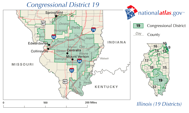
IL-19_congressional_district.gif (635 × 380 píxeles; tamaño de archivo: 35 kB; tipo MIME: image/gif)
Map for Illinois's 19th congressional district.
Source: http://nationalatlas.gov/printable/images/preview/congdist/il19_109.gif archive copy at the Wayback Machine
This map was obtained from an edition of the National Atlas of the United States. Like almost all works of the U.S. federal government, works from the National Atlas are in the public domain in the United States.
Online access: NationalAtlas.gov | 1970 print edition: Library of Congress, Perry-Castañeda Library
|
Historial del archivo
Haz clic sobre una fecha y hora para ver el archivo tal como apareció en ese momento.
| Fecha y hora | Miniatura | Dimensiones | Usuario | Comentario | |
|---|---|---|---|---|---|
| actual | 04:02 31 ene 2007 | | 635 × 380 (35 kB) | Dual Freq | Map for Illinois's 19th congressional district. Source: http://nationalatlas.gov/printable/images/preview/congdist/il19_109.gif {{PD-USGov-Atlas}} Category:Congressional district maps of Illinois |
Usos del archivo
La siguiente página usa este archivo:
Uso global del archivo
Las wikis siguientes utilizan este archivo: