
Archivo:IndianTerritory1885.jpg

Tamaño de esta previsualización: 792 × 600 píxeles. Otras resoluciones: 317 × 240 píxeles · 634 × 480 píxeles · 1015 × 768 píxeles · 1321 × 1000 píxeles.
Ver la imagen en su resolución original (1321 × 1000 píxeles; tamaño de archivo: 413 kB; tipo MIME: image/jpeg)
Resumen
| Descripción |
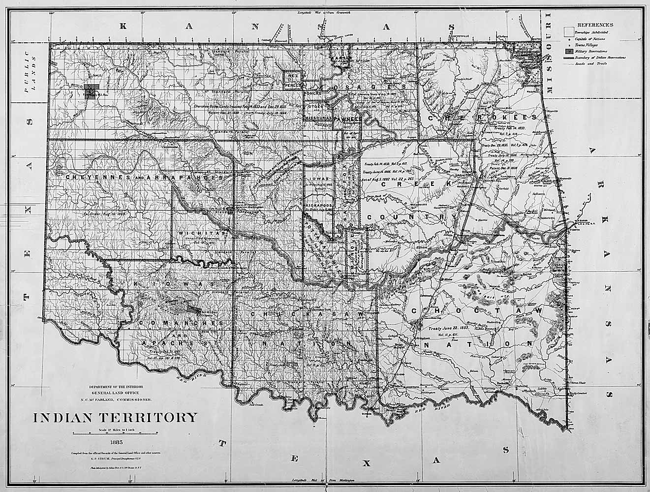
English: Map of Indian territory in Oklahoma in 1885. |
| Fecha | |
| Fuente |
National Archives Federal Indian Policy, direct image here. Source claims the image is available in ARC with identifier NWDC-49-STP-IT1885, but cannot find it. |
| Autor | General Land Office, U.S. Department of the Interior |
Licencia
| This image or media file contains material based on a work of a United States Department of the Interior employee, created as part of that person's official duties. As a work of the U.S. federal government, such work is in the public domain in the United States. See the Department of the Interior copyright policy for more information. |  |
Historial del archivo
Haz clic sobre una fecha y hora para ver el archivo tal como apareció en ese momento.
| Fecha y hora | Miniatura | Dimensiones | Usuario | Comentario | |
|---|---|---|---|---|---|
| actual | 17:48 5 jun 2011 | | 1321 × 1000 (413 kB) | Clindberg | {{Information |Description={{en|Map of Indian territory in Oklahoma in 1885.}} |Source=National Archives [http://www.archives.gov/education/lessons/fed-indian-policy/activities.html Federal Indian Policy], direct image [http://www.archives.gov/education/l |
Usos del archivo
La siguiente página usa este archivo:
Uso global del archivo
Las wikis siguientes utilizan este archivo:
- Uso en ca.wikipedia.org
- Uso en kk.wikipedia.org