
Archivo:Kure Beach North Carolina aerial view.jpg
Tamaño de esta previsualización: 800 × 533 píxeles. Otras resoluciones: 320 × 213 píxeles · 640 × 427 píxeles · 1024 × 683 píxeles · 1500 × 1000 píxeles.
Ver la imagen en su resolución original (1500 × 1000 píxeles; tamaño de archivo: 732 kB; tipo MIME: image/jpeg)
| Descripción |
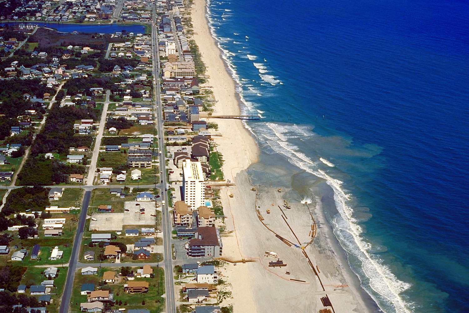
English: Aerial view of Kure Beach, North Carolina, USA. The city is located on the Atlantic Ocean. View is to the north-northeast. At the time this photograph was taken the U.S. Army Corps of Engineers was dredging and replenishing the sand on the beach.
Coordinates: 34°1′6″N 77°53′54.2″W / 34.01833°N 77.898389°W |
|||
| Localización | Kure Beach, North Carolina, USA | |||
| Fecha | not specified or unknown | |||
| Fuente |
U.S. Army Corps of Engineers Digital Visual Library Image page Image description page Digital Visual Library home page |
|||
| Autor | Bud Davis, U.S. Army Corps of Engineers | |||
| Permiso (Reutilización de este archivo) |
|
Historial del archivo
Haz clic sobre una fecha y hora para ver el archivo tal como apareció en ese momento.
| Fecha y hora | Miniatura | Dimensiones | Usuario | Comentario | |
|---|---|---|---|---|---|
| actual | 05:09 26 abr 2007 | | 1500 × 1000 (732 kB) | DanMS | {{Information | Description = {{en|Aerial view of Kure Beach, North Carolina, USA. The city is located on the Atlantic Ocean. View is to the north-northeast. At the time this photograph was taken the U.S. Army Corps of Engineers was dredging and replen |
Usos del archivo
La siguiente página usa este archivo: