
Archivo:Map of Iraq, 1976.jpg

Tamaño de esta previsualización: 621 × 599 píxeles. Otras resoluciones: 249 × 240 píxeles · 497 × 480 píxeles · 796 × 768 píxeles · 1064 × 1027 píxeles.
Ver la imagen en su resolución original (1064 × 1027 píxeles; tamaño de archivo: 395 kB; tipo MIME: image/jpeg)
| Descripción |
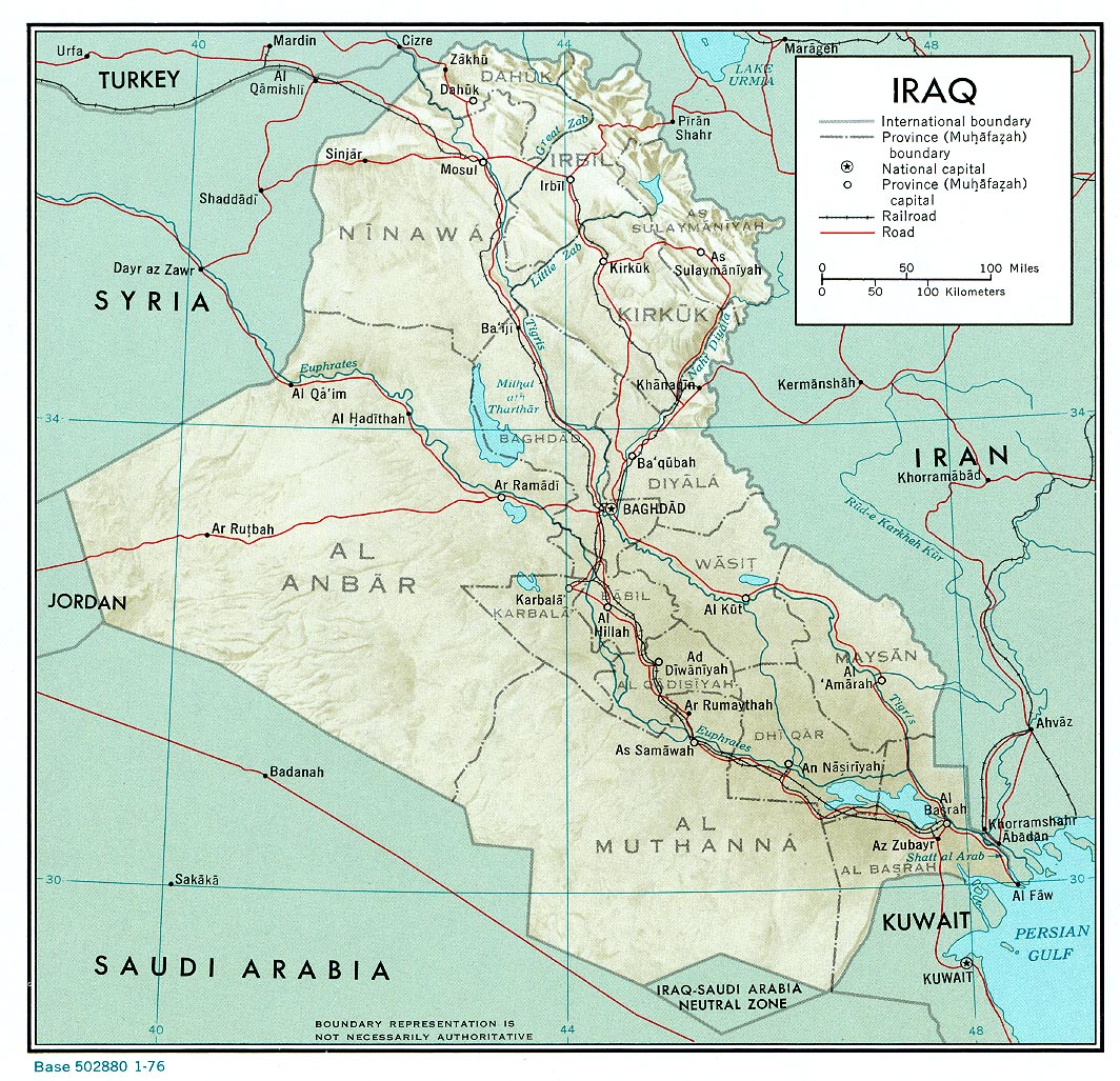
English: A map of Iraq, drawn in 1976. It shows the old province boundaries and other topographical detail. It is referred to here as a work of the CIA. |
|||
| Fecha | ||||
| Fuente | http://www.lib.utexas.edu/maps/middle_east_and_asia/iraq_rel_1976.jpg | |||
| Autor | Employee(s) of the Central Intelligence Agency | |||
| Permiso (Reutilización de este archivo) |
|
|||
| Otras versiones |
File:Neutralzone.jpg, cropped section of Neutral Zone. File:Map of Iraq, 1976-ar.jpg, in Arabic |

Historial del archivo
Haz clic sobre una fecha y hora para ver el archivo tal como apareció en ese momento.
| Fecha y hora | Miniatura | Dimensiones | Usuario | Comentario | |
|---|---|---|---|---|---|
| actual | 13:03 11 jun 2010 | | 1064 × 1027 (395 kB) | Jarry1250 | {{Information |Description={{en|1=A map of Iraq, drawn in 1976. It shows the old province boundaries and other topographical detail. It is referred to [http://www.lib.utexas.edu/maps/iraq.html here] as a work of the CIA.}} |Source=http://www.lib.utexas. |
Usos del archivo
La siguiente página usa este archivo:
Uso global del archivo
Las wikis siguientes utilizan este archivo:
- Uso en ar.wikipedia.org
- Uso en en.wikipedia.org
- Uso en fa.wikipedia.org
- Uso en zh.wikipedia.org