
Archivo:Mexico-2669 - Palenque (2213894589).jpg
Ver la imagen en su resolución original (3308 × 2506 píxeles; tamaño de archivo: 7,78 MB; tipo MIME: image/jpeg)
.jpg?uselang=es)
Resumen
| Descripción |
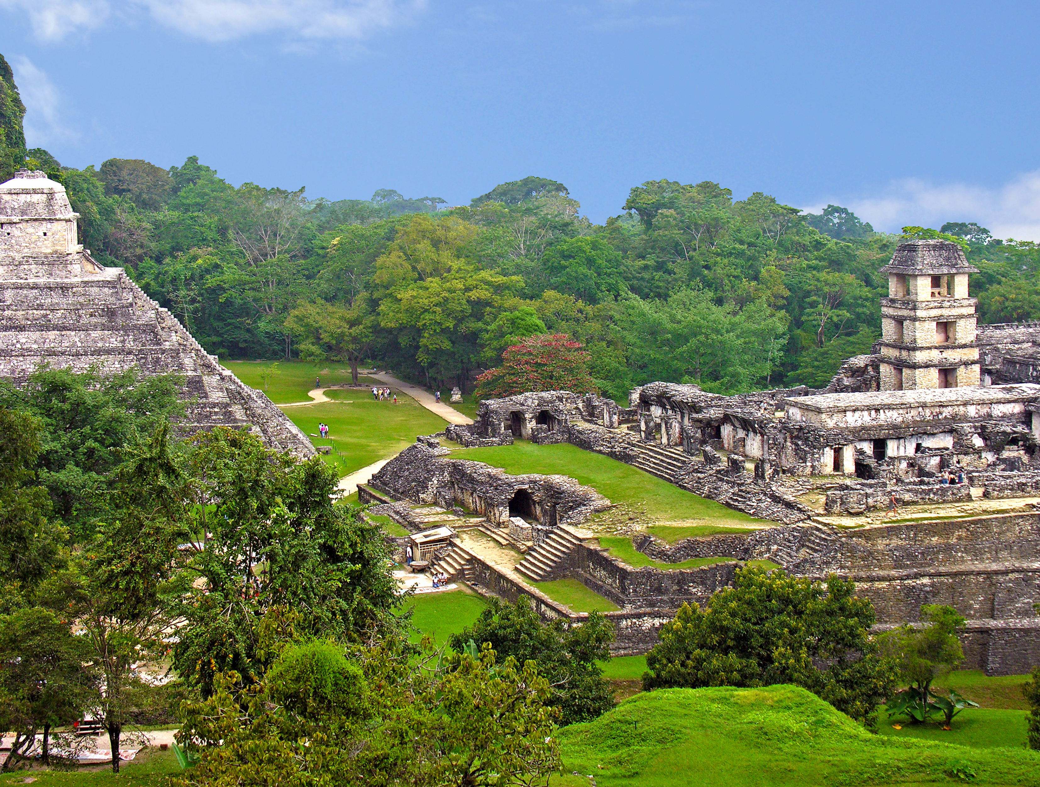
English: The Mayan site of Palenque - View from the Temple of the Cross, Palace complex to the right and Temple of Inscriptions to the left.
Palenque is a Spanish word for "fortification". An ancient name for the city was Lakam Ha, which translates as "Great Water", for the springs and small rivers which flow from the site. Palenque is definitely one of the most beautiful sites in all of Mesoamerica. The richest and most elaborate tomb ever discovered in Mexico is located in the Temple of Inscriptions at Palenque. Lord Pakal's tomb is now closed as is the Temple of Inscriptions. The first permanent settlement of Palenque was about 300 AD. The apex of Maya civilization begins about 600 AD. During the next hundred years, the rulers of Palenque commissioned some of the best Maya artwork discovered. Most of the great structures in Palenque's central area date from this time period. These works were built by the two greatest Palenque rulers, K'inich Janaab' Pakal I and his oldest son, K’inich Kan B’alam II. After 731 AD. most construction had stopped. Unfortunately, Palenque's best known 8th century ruler, K'inich K'an Joy Chitam II, is famous only for his defeat and capture in 711 AD by the new military power of Tonina. By 810 AD. the ritual activity in Palenque comes to an end. Then by 900 AD. Palenque becomes deserted and reclaimed by the forest. |
| Fecha | |
| Fuente | Mexico-2669 - Palenque |
| Autor | Dennis Jarvis from Halifax, Canada |
| Posición de la cámara | | Ubicación de esta y otras imágenes en: OpenStreetMap |
|---|
.jpg¶ms=017.376852_N_-091.996765_E_globe:Earth_type:camera_source:Flickr_&language=es)
Licencia
- Eres libre:
- de compartir – de copiar, distribuir y transmitir el trabajo
- de remezclar – de adaptar el trabajo
- Bajo las siguientes condiciones:
- atribución – Debes otorgar el crédito correspondiente, proporcionar un enlace a la licencia e indicar si realizaste algún cambio. Puedes hacerlo de cualquier manera razonable pero no de manera que sugiera que el licenciante te respalda a ti o al uso que hagas del trabajo.
- compartir igual – En caso de mezclar, transformar o modificar este trabajo, deberás distribuir el trabajo resultante bajo la misma licencia o una compatible como el original.
| Esta imagen fue publicada en Flickr por archer10 (Dennis) REPOSTING en https://www.flickr.com/photos/22490717@N02/2213894589. La imagen fue revisada el 28 de mayo de 2015 por el robot FlickreviewR y confirmó tener licencia bajo los términos de cc-by-sa-2.0. |
Historial del archivo
Haz clic sobre una fecha y hora para ver el archivo tal como apareció en ese momento.
| Fecha y hora | Miniatura | Dimensiones | Usuario | Comentario | |
|---|---|---|---|---|---|
| actual | 16:28 28 may 2015 | | 3308 × 2506 (7,78 MB) | Wilfredor | Transferred from Flickr via Flickr2Commons |
Usos del archivo
Las siguientes páginas usan este archivo:
Uso global del archivo
Las wikis siguientes utilizan este archivo:
- Uso en en.wikibooks.org
- Uso en ko.wikipedia.org
- Uso en pt.wikipedia.org
.jpg)