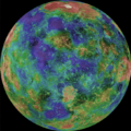
Archivo:Venus2 mag big.png

Tamaño de esta previsualización: 600 × 600 píxeles. Otras resoluciones: 240 × 240 píxeles · 480 × 480 píxeles · 656 × 656 píxeles.
Ver la imagen en su resolución original (656 × 656 píxeles; tamaño de archivo: 344 kB; tipo MIME: image/png)
Historial del archivo
Haz clic sobre una fecha y hora para ver el archivo tal como apareció en ese momento.
| Fecha y hora | Miniatura | Dimensiones | Usuario | Comentario | |
|---|---|---|---|---|---|
| actual | 17:42 17 dic 2010 |  | 656 × 656 (344 kB) | LobStoR | Reverted to version as of 08:46, 11 June 2006 -- nevermind, looked terrible |
| 17:40 17 dic 2010 |  | 656 × 656 (281 kB) | LobStoR | transparency | |
| 08:46 11 jun 2006 |  | 656 × 656 (344 kB) | BillC | ===Beneath Venus' Clouds=== If the thick clouds covering Venus were removed, how would the surface appear? Using an imaging radar technique, the Magellan spacecraft was able to lift the veil from the Face of Venus and produce this spectacular high resolu |
Usos del archivo
La siguiente página usa este archivo:
Uso global del archivo
Las wikis siguientes utilizan este archivo:
- Uso en ar.wikipedia.org
- Uso en ast.wikipedia.org
- Uso en be.wikipedia.org
- Uso en bg.wikipedia.org
- Uso en cv.wikipedia.org
- Uso en en.wikibooks.org
- Uso en en.wikiversity.org
- Solar System, technical/Venus
- User:Marshallsumter/Radiation astronomy1/Planets/Sciences
- User:Marshallsumter/Radiation astronomy2/Yellows
- User:Marshallsumter/Radiation astronomy2/Radios
- Draft:Original research/Venus
- Planets/Astronomy
- User:Marshallsumter/Radiation astronomy2/Radars
- User:Marshallsumter/Rocks/Rocky objects
- User:Marshallsumter/Radiation astronomy/Centimeters
- Uso en eo.wikipedia.org
- Uso en eu.wikipedia.org
- Uso en fr.wikipedia.org
- Uso en hi.wikipedia.org
- Uso en hr.wikipedia.org
- Uso en hu.wikipedia.org
- Uso en hy.wikipedia.org
- Uso en id.wikipedia.org
- Uso en it.wikipedia.org
- Uso en kn.wikipedia.org
- Uso en ko.wikibooks.org
- Uso en ml.wikipedia.org
- Uso en no.wikipedia.org
- Uso en pl.wikipedia.org
- Uso en pt.wikipedia.org
- Uso en ro.wikipedia.org
- Uso en ru.wikipedia.org
- Uso en sh.wikipedia.org
- Uso en sk.wikipedia.org
- Uso en sl.wikipedia.org
- Uso en sq.wikipedia.org
- Uso en sr.wikipedia.org
- Uso en uk.wikipedia.org
- Uso en vi.wikipedia.org


