
Archivo:Vile Vortices Map.png

No se dispone de una resolución más alta.
Vile_Vortices_Map.png (696 × 291 píxeles; tamaño de archivo: 414 kB; tipo MIME: image/png)
Resumen
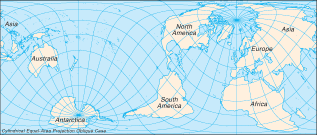
| Descripción |
English: Map showing the approximate locations of the Vile Vortices. Français : Carte montrant les emplacements approximatifs des tourbillons géomagnétiques terrestres. |
| Fecha | 3 de marzo de 2006 (fecha original de carga) |
| Fuente | The Vile Vortice locations (shown in green) were added by the Wikipedia User. |
| Autor | Kiwipat at en.wikipedia |
Licencia
| Este trabajo ha sido liberado al dominio público por su autor, Kiwipat de Wikipedia en inglés. Esto aplica para todo el mundo. En algunos países esto puede no ser legalmente factible; si ello ocurriese: Kiwipat otorga a cualquier persona el derecho de usar este trabajo para cualquier propósito, sin ningún tipo de condición, a menos que éstas sean requeridas por la ley. |
| Esta imagen se encuentra en el dominio público ya que su contenido proviene de un trabajo de la Agencia Central de Inteligencia de los Estados Unidos de América.
|

|
This file was reviewed on 20 de octubre de 2011 by the administrator or trusted user Magog the Ogre (talk), who confirmed the Public Domain status on that date.
|
Registro original de carga
Aquí se muestra la página de descripción original. Los siguientes nombres de usuario se refieren a en.wikipedia.
Upload date | User | Bytes | Dimensions | Comment
- 2009-01-01 22:02 (UTC) | Kiwipat | 424342 (bytes) | 696×291 | best version
- 2009-01-01 20:44 (UTC) | Kiwipat | 45529 (bytes) | 635×272 |
- 2009-01-01 20:29 (UTC) | Kiwipat | 47421 (bytes) | 635×272 |
- 2006-03-03 00:58 (UTC) | Kiwipat | 27838 (bytes) | 635×272 | Map showing the approximate locations of the Vile Vortices. The original map is from the online Perry-Castañeda Library Map Collection. It is posted here courtesy of the University of Texas Libraries, The University of Texas at Austin. The Vile Vortice
Historial del archivo
Haz clic sobre una fecha y hora para ver el archivo tal como apareció en ese momento.
| Fecha y hora | Miniatura | Dimensiones | Usuario | Comentario | |
|---|---|---|---|---|---|
| actual | 10:00 11 oct 2011 | | 696 × 291 (414 kB) | SreeBot | (Original text) : best version |
| 10:00 11 oct 2011 |  | 635 × 272 (44 kB) | SreeBot | ||
| 10:00 11 oct 2011 |  | 635 × 272 (46 kB) | SreeBot | ||
| 10:00 11 oct 2011 |  | 635 × 272 (27 kB) | SreeBot | (Original text) : Map showing the approximate locations of the Vile Vortices. The original map is from the online Perry-Castañeda Library Map Collection. It is posted here courtesy of the University of Texas Libraries, The University of Texas at Austin. |
Usos del archivo
La siguiente página usa este archivo:
Uso global del archivo
Las wikis siguientes utilizan este archivo:
- Uso en fi.wikipedia.org
- Uso en fr.wikipedia.org
- Uso en ro.wikipedia.org