| #
|
Año designación
|
Nombre
|
Imagen
|
Built
|
Ubicación
Coordinates
|
Región/estado/zona
|
País
|
Categoría
|
| 1
|
1966
|
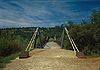
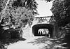
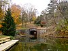
Puente Bollman Truss
|

|
1869
|
Savage
39°8′5.4″N 76°49′30.3″O / 39.134833, -76.825083 (Bollman Truss Bridge)
|
Maryland
|
Estados Unidos
|
Puentes
|
| 2
|
1967
|
Puente Bidwell Bar
|
|
1856
|
Oroville
39°32′14.8″N 121°27′15.6″O / 39.537444, -121.454333 (Bidwell Bar Bridge)
|
California
|
Estados Unidos
|
Puentes
|
| 3
|
1967
|
Canal de Erie
|

|
1825
|
Río Hudson a Lago Erie
43°2′35.6″N 76°1′20.2″O / 43.043222, -76.022278 (Erie Canal)
|
Nueva York
|
Estados Unidos
|
Obras hidráulicas
|
| 4
|
1967
|
Canal Middlesex
|

|
1803
|
Condado de Middlesex
42°30′21.4″N 71°9′25.8″O / 42.505944, -71.157167 (Middlesex Canal)
|
Massachusetts
|
Estados Unidos
|
Obras hidráulicas
|
| 5
|
1968
|
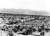
Central Pacific Railroad
|
|
1863–1869
|
Sacramento
38°34′57″N 121°30′22.8″O / 38.58250, -121.506333 (Central Pacific Railroad)
|
California
|
Estados Unidos
|
Carreteras y ferrocarriles
|
| 6
|
1968
|
Ferrocarril de vía Estrecha Durango y Silverton
|

|
1882
|
Durango
37°35′27.7″N 107°46′41.6″O / 37.591028, -107.778222 (Durango-Silverton Branch of the D&RGW RR)
|
Colorado
|
Estados Unidos
|
Carreteras y ferrocarriles
|
| 7
|
1968
|
Ellicott's Stone
|

|
1799
|
Mobile
30°59′52″N 88°1′21.1″O / 30.99778, -88.022528 (Ellicott's Stone)
|
Alabama
|
Estados Unidos
|
Fronteras y mediciones
|
| 8
|
1968
|
Espada Acequia
|

|
1718
|
San Antonio (Texas)
29°19′57.1″N 98°27′41.1″O / 29.332528, -98.461417 (Acequias of San Antonio)
|
Texas
|
Estados Unidos
|
Abastecimiento y control de agua
|
| 9
|
1968
|
Unión de las vías del Ferrocarril Transcontinental
|
|
1869
|
Promontory
41°37′4.7″N 112°33′5.8″O / 41.617972, -112.551611 (Joining of the Rails - Transcontinental Railroad)
|
Utah
|
Estados Unidos
|
Carreteras y ferrocarriles
|
| 10
|
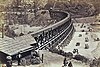
1968
|
Puente Colgante de Wheeling
|
|
1849
|
Wheeling
40°4′12.8″N 80°43′36.7″O / 40.070222, -80.726861 (Wheeling Suspension Bridge)
|
Virginia Occidental
|
Estados Unidos
|
Puentes
|
| 11
|
1969
|
Puente del Lago Alvord
|
|
1889
|
San Francisco
37°46′8.4″N 122°27′17.6″O / 37.769000, -122.454889 (Alvord Lake Bridge)
|
California
|
Estados Unidos
|
Puentes
|
| 12
|
1969
|
Ferrocarril Charleston - Hamburg
|

|
1833
|
Charleston a Hamburg
32°47′22.9″N 79°56′15.8″O / 32.789694, -79.937722 (Charleston - Hamburg Railroad)
|
Carolina del Sur
|
Estados Unidos
|
Carreteras y ferrocarriles
|
| 13
|
1970
|
Presa de molino Ascutney
|
|
1834
|
Windsor
43°28′35″N 72°23′44.5″O / 43.47639, -72.395694 (Ascutney Mill Dam)
|
Vermont
|
Estados Unidos
|
Presas
|
| 14
|
1970
|
Puente cubierto de Bridgeport
|
|
1862
|
Condado de Nevada
39°17′34.2″N 121°11′41.7″O / 39.292833, -121.194917 (Bridgeport Covered Bridge)
|
California
|
Estados Unidos
|
Puentes
|
| 15
|
1970
|
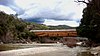
Puente Cubierto de Cornish–Windsor
|
|
1866, reconstruido en 1988
|
Windsor a Cornish
43°28′25.3″N 72°23′2.1″O / 43.473694, -72.383917 (Cornish–Windsor Covered Bridge)
|
Vermont y Nuevo Hampshire
|
Estados Unidos
|
Puentes
|
| 16
|
1970
|
Puente de la avenida Frankford
|

|
1697
|
Filadelfia
40°2′36.7″N 75°1′14″O / 40.043528, -75.02056 (Frankford Avenue Bridge)
|
Pensilvania
|
Estados Unidos
|
Puentes
|
| 17
|
1970
|
Canal Potowmack
|

|
1799
|
Great Falls
38°59′25.3″N 77°14′58.1″O / 38.990361, -77.249472 (Potowmack Canal and Locks)
|
Virginia
|
Estados Unidos
|
Obras hidráulicas
|
| 18
|
1970
|
Presa Theodore Roosevelt y Proyecto Salt River
|

|
1911
|
33°40′17.9″N 111°9′40.8″O / 33.671639, -111.161333 (Theodore Roosevelt Dam & Salt River Project)
|
Arizona
|
Estados Unidos
|
Abastecimiento y control de agua
|
| 19
|
1970
|
Tunel Union Canal
|
|
1828
|
Lebanon
40°20′58.5″N 76°27′41″O / 40.349583, -76.46139 (Union Canal Tunnel)
|
Pensilvania
|
Estados Unidos
|
Obras hidráulicas
|
| 20
|
1971
|
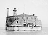
Bethlehem Waterworks
|

|
1761
|
Bethlehem
40°37′8.7″N 75°22′58.2″O / 40.619083, -75.382833 (Bethlehem Waterworks)
|
Pensilvania
|
Estados Unidos
|
Abastecimiento y control de agua
|
| 21
|
1971
|
Presa del lago Druid
|

|
1871
|
Baltimore
39°19′7″N 76°37′53″O / 39.31861, -76.63139 (Druid Lake Dam)
|
Maryland
|
Estados Unidos
|
Presas
|
| 22
|
1971
|
Puente Eads
|

|
1874
|
St. Louis
38°37′44″N 90°10′43.3″O / 38.62889, -90.178694 (Eads Bridge)
|
Missouri
|
Estados Unidos
|
Puentes
|
| 23
|
1971
|
Primer río Owens - Acueducto de los Ángeles
|
|
1913
|
Valle Owens
36°58′32.4″N 118°12′38″O / 36.975667, -118.21056 (First Owens River - Los Angeles Aqueduct)
|
California
|
Estados Unidos
|
Abastecimiento y control de agua
|
| 24
|
1971
|
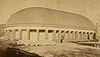
Tabernáculo Mormón
|
|
1867
|
Salt Lake City
40°46′13.6″N 111°53′35.3″O / 40.770444, -111.893139 (Mormon Tabernacle)
|
Utah
|
Estados Unidos
|
Edificios
|
| 25
|
1972
|
Acueducto Cabin John
|

|
1863
|
Cabin John
38°58′22″N 77°8′54.9″O / 38.97278, -77.148583 (Cabin John Aqueduct)
|
Maryland
|
Estados Unidos
|
Abastecimiento y control de agua
|
| 26
|
1972
|
Sistema de suministro de agua de Chicago de Chesbrough.
|
|
1869
|
Chicago
41°53′49.8″N 87°37′27.9″O / 41.897167, -87.624417 (Chesbroughs Water Supply System Chicago)
|
Illinois
|
Estados Unidos
|
Abastecimiento y control de agua
|
| 27
|
1972
|
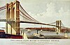
Puente de Brooklyn
|
|
1883
|
Nueva York
40°42′22″N 73°59′48.8″O / 40.70611, -73.996889 (Brooklyn Bridge)
|
New York
|
Estados Unidos
|
Puentes
|
| 28
|
1972
|
Túnel Gunnison
|

|
1909
|
Montrose
38°29′36″N 107°43′17″O / 38.49333, -107.72139 (Gunnison Tunnel)
|
Colorado
|
Estados Unidos
|
Túneles
|
| 29
|
1972
|
Acueducto Roebling's Delaware del Canal Delaware y Hudson
|

|
1848, restaurado en 1983
|
Lackawaxen a Minisink Ford
41°28′57.5″N 74°59′4.1″O / 41.482639, -74.984472 (Roebling's Delaware Aqueduct of the Delaware & Hudson Canal)
|
Pensilvania y New York
|
Estados Unidos
|
Obras hidráulicas
|
| 30
|
1972
|
Miami Conservancy District
|

|
1922
|
Cerca de Dayton
39°45′49.2″N 84°11′29.2″O / 39.763667, -84.191444 (Miami Conservancy District)
|
Ohio
|
Estados Unidos
|
Abastecimiento y control de agua
|
| 31
|
1973
|
Presa Buffalo Bill
|

|
1910
|
Cody
44°30′5.3″N 109°10′59.4″O / 44.501472, -109.183167 (Buffalo Bill Dam)
|
Wyoming
|
Estados Unidos
|
Presas
|
| 32
|
1973
|
Presa Cheesman
|

|
1905
|
Suroeste de Denver
39°12′27″N 105°16′20.1″O / 39.20750, -105.272250 (Cheesman Reservoir)
|
Colorado
|
Estados Unidos
|
Presas
|
| 33
|
1973
|
Sección de aforo de Embudo
|

|
1889
|
Embudo
36°12′18.4″N 105°57′49.2″O / 36.205111, -105.963667 (Embudo Stream Gauging Station)
|
New Mexico
|
Estados Unidos
|
Abastecimiento y control de agua
|
| 34
|
1973
|
Ingalls Building
|

|
1903
|
Cincinnati
39°6′1″N 84°30′45.1″O / 39.10028, -84.512528 (Ingalls Building)
|
Ohio
|
Estados Unidos
|
Edificios
|
| 35
|
1973
|
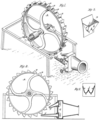
Turbina Pelton
|
|
1878
|
Camptonville
39°27′7″N 121°2′55″O / 39.45194, -121.04861 (Pelton Impulse Water Wheel)
|
California
|
Estados Unidos
|
Generación de energía
|
| 36
|
1973
|
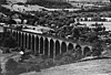
Viaducto Starrucca
|
|
1848
|
Lanesboro
41°57′51.3″N 75°35′0.6″O / 41.964250, -75.583500 (Starrucca Viaduct)
|
Pensilvania
|
Estados Unidos
|
Puentes
|
| 37
|
1974
|
Kansas City Parks y sistemas de boulevards
|
|
1893 a 1915
|
Kansas City
39°4′57″N 94°33′18″O / 39.08250, -94.55500 (Kansas City Park and Boulevard System)
|
Missouri
|
Estados Unidos
|
Fronteras y mediciones
|
| 38
|
1974
|
Planta de Tratamiento de aguas residuales de Milwaukee
|
|
1919
|
Milwaukee
43°1′21.3″N 87°53′57.3″O / 43.022583, -87.899250 (Milwaukee Metropolitan Sewage Treatment Plant)
|
Wisconsin
|
Estados Unidos
|
Abastecimiento y control de agua
|
| 39
|
1974
|
Suministro de agua municipal de Filadelfia
|
|
1801
|
Filadelfia
39°57′56″N 75°10′51″O / 39.96556, -75.18083 (Philadelphia Municipal Water Supply)
|
Pensilvania
|
Estados Unidos
|
Abastecimiento y control de agua
|
| 40
|
1974
|
Puente Stone Arch
|
|
1883
|
Mineápolis
44°58′50.8″N 93°15′12.3″O / 44.980778, -93.253417 (Stone Arch Bridge)
|
Minnesota
|
Estados Unidos
|
Puentes
|
| 41
|
1975
|
Castillo de San Marcos
|

|
1695
|
San Agustín
29°53′52″N 81°18′41″O / 29.89778, -81.31139 (Castillo de San Marcos)
|
Florida
|
Estados Unidos
|
Edificios
|
| 42
|
1975
|
Sistema de suministro de agua de Croton
|
|
1842
|
Nueva York
41°0′42.5″N 73°52′36.4″O / 41.011806, -73.876778 (Croton Water Supply System)
|
Nueva York
|
Estados Unidos
|
Abastecimiento y control de agua
|
| 43
|
1975
|
Sistema de energía hidroeléctrica de Folsom
|

|
1895
|
Folsom
38°40′46.6″N 121°10′37.2″O / 38.679611, -121.177000 (Folsom Hydroelectric Power System)
|
California
|
Estados Unidos
|
Generación de energía
|
| 44
|
1975
|
Granite Railway
|
|
1826
|
Quincy
42°14′44.6″N 71°2′9″O / 42.245722, -71.03583 (Granite Railway)
|
Massachusetts
|
Estados Unidos
|
Carreteras y ferrocarriles
|
| 45
|
1975
|
Túnel Hoosac
|
|
1875
|
Condado de Berkshire
42°40′31.1″N 73°2′45.1″O / 42.675306, -73.045861 (Hoosac Tunnel)
|
Massachusetts
|
Estados Unidos
|
Túneles
|
| 46
|
1975
|
Lawrence Experiment Station
|
|
1886
|
Lawrence
42°41′53.8″N 71°9′55.7″O / 42.698278, -71.165472 (Lawrence Experiment Station)
|
Massachusetts
|
Estados Unidos
|
research & educational
|
| 47
|
1975
|
Sistema de agua del lago Marlette
|
|
1873 a 1887
|
Virginia City
39°13′9.5″N 119°47′20.1″O / 39.219306, -119.788917 (Marlette Lake Water System)
|
Nevada
|
Estados Unidos
|
Abastecimiento y control de agua
|
| 48
|
1975
|
Mount Washington Cog Railway
|
|
1869
|
Monte Washington
44°16′26″N 71°19′55″O / 44.27389, -71.33194 (Mount Washington Cog Railway)
|
Nuevo Hampshire
|
Estados Unidos
|
Carreteras y ferrocarriles
|
| 49
|
1975
|
Smithfield Street Bridge
|

|
1883
|
Pittsburgh
40°26′5.4″N 80°0′7.7″O / 40.434833, -80.002139 (Smithfield Street Bridge)
|
Pensilvania
|
Estados Unidos
|
Puentes
|
| 50
|
1975
|
Viaducto Tunkhannock
|
|
1915
|
Nicholson
41°37′34.2″N 75°46′34.4″O / 41.626167, -75.776222 (Tunkhannock Viaduct)
|
Pensilvania
|
Estados Unidos
|
Puentes
|


.jpg)


.png)


.jpg)
.jpg)


_-_Geographicus_-_CarolinaGeorgia-bowen-1747.jpg)

_Spillway_01.jpg)


.jpg)


1940.jpg)


.jpg)


_001.jpg)


.jpg)


.jpg)


.jpg)
.jpg)
.jpg)


